You don't have to dig far in Tempe before hitting something that changes the plan. In our experience running lab and field programs across the East Valley, the transition from soft alluvial silts into heavily cemented conglomerate—what local contractors call caliche—happens abruptly and without much warning between Arizona State University and the Loop 101 corridor. That interface zone drives most of the design decisions for a deep excavation here. We've watched shoring systems that worked fine in Gilbert struggle the moment they crossed into the harder bands north of the US 60. The CPT test gives us a continuous resistance profile through those transitions, which matters a lot more than N-values when you're trying to map exactly where the bucket teeth are going to start sparking.
In the Tempe basin, the real design challenge isn't just the depth—it's predicting how the excavation will behave when you go from butter-soft alluvium into rock-hard caliche in the same morning shift.
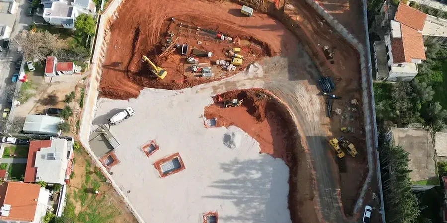
Scope of work in Tempe Arizona
Demonstration video
Risks and considerations in Tempe Arizona
The risk profile changes noticeably between the older neighborhoods south of Broadway—where groundwater is shallower and the Salt River's historic channel left pockets of loose, poorly graded sand—and the higher benches near the base of Hayden Butte, where the overconsolidated claystone provides a stiffer response but brings a different problem: relaxation cracking in unsupported vertical cuts during the summer when surface temperatures exceed 110°F and the exposed face desiccates within hours. We've instrumented excavations in both settings and the deformation pattern is completely different. In the loose sand zones, the concern is basal instability and piping at the toe when the water table isn't adequately depressed. In the hard claystone, the real headache is block fallout from joint-controlled failure along pre-existing fracture planes—something a conventional factor of safety calculation won't catch unless you map the discontinuity orientation during the initial test pit or borehole logging phase.
Our services
Deep excavation design in central Arizona requires more than an off-the-shelf earth pressure diagram. The cemented soils and rapid stratigraphic changes demand a site-specific approach that we deliver through the following services.
Lateral Earth Pressure Development
We build project-specific pressure envelopes based on laboratory-measured effective stress parameters and field CPT data, not just default ka/kp values. For mixed caliche-sand profiles common along the Tempe Town Lake area, this avoids overconservatism in the upper layers while ensuring adequate shoring stiffness in the cemented zone.
Construction Sequencing and Staged Excavation Analysis
We model the step-by-step excavation geometry, brace preloading, and dewatering stages using 2D and 3D finite element tools. This is particularly critical in Tempe's urban infill sites where adjacent buildings are within the zone of influence and settlement control drives the bracing schedule.
Instrumentation and Monitoring Plan Design
We specify inclinometer locations, surface settlement points, and piezometer arrays tied to threshold values derived from the deformation analysis. For excavations deeper than 20 feet near ASU campus structures, this plan becomes the contractual trigger for contingency measures.
Quick answers
What does a deep excavation design package include for a Tempe project?
A typical package from our lab includes a geotechnical data report with site-specific stratigraphy, a lateral earth pressure envelope, a global stability analysis for the temporary excavation, a basal heave check, a dewatering assessment, and a construction sequence narrative that defines bracing levels and preloads. If the excavation is within the zone of influence of existing structures, we add a deformation analysis with predicted ground movements and an instrumentation plan with threshold values.
How much does geotechnical design for a deep excavation cost in Tempe?
For a typical commercial excavation in the Tempe area—say 15 to 30 feet deep with a standard soldier pile and lagging system—the geotechnical design portion generally falls between US$2,210 and US$7,810 depending on the complexity of the stratigraphy, the number of adjacent structures requiring settlement analysis, and whether 3D finite element modeling is required. Very deep or complex excavations with multiple bracing levels and extensive instrumentation plans will be at the upper end or slightly above that range.
How does caliche affect deep excavation design in Tempe?
Caliche in the Tempe basin is highly variable—sometimes it's a weakly cemented silt that crumbles under a backhoe bucket, and other times it's a massive carbonate-cemented conglomerate that requires rock excavation tools. In our design approach, we treat caliche as a transitional material using geological strength index (GSI) methods. The key is identifying its top elevation accurately from CPT refusal data and sonic coring, because the lateral stress on the shoring system increases dramatically in the cemented zone, and the excavation productivity assumptions in the contractor's means and methods depend entirely on how hard that layer actually is.