A few years back, a mixed-use project on Apache Boulevard required a 28-foot cut right next to a vintage 1950s masonry building. The general contractor was nervous—and understandably so. The excavation was in the Salt River Valley’s layered deposits, where you can go from stiff sandy clay to loose river cobbles in less than six vertical feet. We instrumented the wall with inclinometers and optical survey points, and within the first week of dewatering, the data showed a minor lateral shift in the upper 10 feet. That early catch allowed the shoring designer to adjust tieback preload before anything cracked. In Tempe, with the water table often sitting just 12 to 18 feet below grade near the old riverbed and summer temperatures pushing 110°F, excavation monitoring isn’t a checkbox—it’s a live feedback loop. For projects near the historic districts or the dense infill around Arizona State University, we pair monitoring with a deep excavation design review to ensure the support system and the instrumentation plan speak the same language.
In Tempe’s layered alluvium, the difference between a stable cut and a costly repair often comes down to reading inclinometer data before the Friday afternoon meeting.
Scope of work in Tempe Arizona
Risks and considerations in Tempe Arizona
Tempe’s transformation from a small agricultural town into a dense urban core over the past four decades has left a legacy of adjacent construction challenges. Many of the original one-story commercial buildings along Mill Avenue and the neighborhoods west of ASU were built on shallow spread footings without any consideration for a future 20-story tower next door. When you excavate 25 feet down for a new parking garage, the zone of influence can extend well beyond the property line, potentially undermining those older footings. The biggest risk isn’t catastrophic wall collapse—it’s incremental settlement that cracks a neighbor’s slab or tilts a historic storefront. In Tempe’s silty alluvium, consolidation settlement from dewatering is often the hidden culprit, not just lateral wall movement. A properly instrumented site catches both. Without continuous monitoring data, a contractor has no objective way to prove that vibration or settlement complaints from a neighboring property owner are within acceptable limits or unrelated to the work.
Our services
Our Tempe excavation monitoring scope is tailored to the shoring system, the sensitivity of adjacent structures, and the depth of cut. We don’t sell a one-size-fits-all package—the instrumentation plan is driven by the project’s specific risk profile.
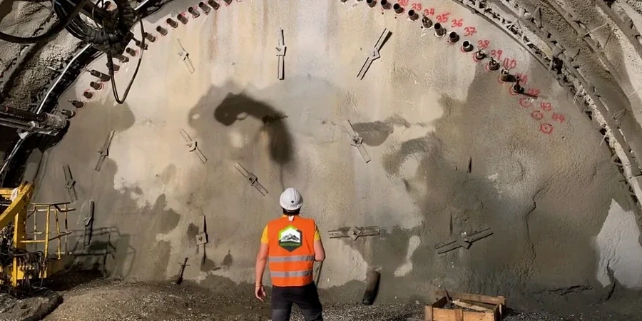
Inclinometer and Shape Array Monitoring
Vertical casings installed behind the shoring wall to track subsurface lateral movement with depth. We use both traditional traversing probes and fixed-in-place shape arrays for automated, near-continuous data.
Optical Survey and Settlement Points
Precision total-station monitoring of settlement points on adjacent sidewalks, utilities, and building facades. Baseline readings taken before excavation begins, with threshold alerts tied to the structural condition survey.
Piezometer and Groundwater Monitoring
Vibrating wire piezometers installed at multiple depths to track pore pressure changes during dewatering. In Tempe’s layered soils, perched water is common, and a single water-level reading from the excavation sump doesn’t tell the full story.
Crack Gauge and Vibration Monitoring
Tell-tale crack gauges mounted on existing cracks in adjacent structures, plus triaxial geophones when rock breaking or heavy compaction is planned. All data time-stamped and correlated with the contractor’s daily activity log.
Quick answers
At what depth does the City of Tempe require excavation monitoring?
Tempe follows the IBC with local amendments. The trigger isn’t a fixed depth—it’s based on the zone of influence and proximity to adjacent structures. Generally, any excavation deeper than 10 feet that extends below the footing elevation of a neighboring building within a horizontal distance equal to the cut depth will require an instrumentation and monitoring plan signed by a registered engineer. The city’s plan review staff will look for inclinometers and settlement points when the shoring permit is submitted. For cuts over 20 feet near occupied buildings, we almost always specify automated data collection with daily reporting during critical phases.
What’s the typical cost range for excavation monitoring on a Tempe infill project?
For a standard infill lot in Tempe with one or two adjacent structures and a 15–25 foot cut, monitoring programs usually run between US$840 and US$2.190 per month depending on the number of instruments, read frequency, and whether automated data loggers are used. A simpler setup with manual inclinometer readings and weekly optical surveys sits at the lower end. A fully automated system with web-based data access, multiple shape arrays, and real-time alerting falls at the upper end.
How long must monitoring continue after the excavation reaches subgrade?
The monitoring period extends through the entire excavation and construction cycle until the permanent floor slabs and lateral bracing are in place and dewatering has stopped. In Tempe, where summer monsoon storms can suddenly raise the local groundwater, we typically recommend maintaining piezometers and selected survey points for at least 30 days after backfill and dewatering system shutdown, to confirm that pore pressures have stabilized and no post-construction settlement is developing beneath adjacent footings.